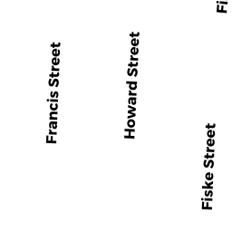
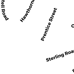
83 R FRANCIS ST
Owner Information
MICHAEL J. WIGHTMAN REV. TR;
37 AMHERST AVENUE
WALTHAM, MA 02451-3201


Property Details
83 R FRANCIS ST is classified as a Two-Family Residential (Two family).
The primary structure on this property was built in 1910. There are 2,021ft2 of built area within this property. There is 2,021ft2 of residential/living space within this property. This property is listed as having 6 rooms. There are 2 units within this property.
83 R FRANCIS ST is valued at $640,600. The land is valued at $287,400 and the structures are valued at $352,400. There is an additional valuation of $800 on this property.
The most recent deed for 83 R FRANCIS ST is recorded at the local registrar in Book 74074, Page 349. 83 R FRANCIS ST was last sold on Friday, January 31, 2020 for $1.
Assessment data from fiscal year 2022.
Flood Data
According to the FEMA National Flood Hazard Layer, this property does not appear to be in a flood zone. It may also be in an area not yet reviewed. Nonetheless, confirm this information prior to taking any action.
To view the flood hazards around this property, create a FEMA "Firmette" Map of the area around 83 R FRANCIS ST.
Broadband Internet Providers
| Provider | Type | Bandwidth (mbps) | |
|---|---|---|---|
| Verizon New England Inc. | DSL | 15 | 1 |
| RCN | Cable | 500 | 20 |
| Comcast | Cable | 1000 | 35 |
| RCN | Cable | 1000 | 20 |
| GCI Communication Corp. | Satellite | 0 | 0 |
| HughesNet | Satellite | 25 | 3 |
| VSAT Systems, LLC. | Satellite | 2 | 1 |
| Crown Castle Fiber | Fiber | 0 | 0 |
| Viasat Inc | Satellite | 100 | 3 |
| Verizon New England Inc. | Fiber | 940 | 880 |
Broadband service provider data from December 2020.
Adjacent Properties
- 80 -82 HOWARD ST
Two-Family Residential owned by BEDARD, WILLIAM J. & JOYCE . - 86 -2 HOWARD ST
Residential Condominium owned by DENG WANG FAMILY TRUST; - 86 -1 HOWARD ST
Residential Condominium owned by BRILLINGER, MARNEY S. & PETER - 87 FRANCIS ST
Single Family Residential owned by LUSSIER, RICHARD E. & - 85 FRANCIS ST
Single Family Residential owned by RAIMONDI, MARCELLO & - 79 -2 FRANCIS ST
Residential Condominium owned by PUKMA, NAMMON & KUMLA - 79 -1 FRANCIS ST
Residential Condominium owned by MUNOZ, MICHAEL & SAMANTHA